|
|
EMAIL US, VT Land Surveyor  802-463-3031 or 603-358-5509
440 Rockingham Road Bellows Falls, VT
2 Taylor Street No. Walpole, NH 03609
802-463-3031 or 603-358-5509
440 Rockingham Road Bellows Falls, VT
2 Taylor Street No. Walpole, NH 03609
 |
|
What type of NH VT
Land Survey Project
do you need completed? |
Vermont,
land, survey, surveyor,
land surveyors |
|
Homepage - Land Surveying Frequently Asked Questions FAQs
In general, a survey should be made before purchasing real property, when dividing any parcel of land for sale or when adjusting existing parcel boundaries (in conformance with state laws and local ordinances), and prior to the construction of any improvements on property in which you have an interest. Boundary surveys are also frequently requested to establish a line between two properties when a disputes arise.
Here are some Frequently Asked Questions about Land Surveying.
Q: Why would I need a Land Survey?
A: To find out the boundaries, or features of your land. To build, to develop, to satisfy local code or building requirements. To find out whether you have encroachments on your land or not. To find out where the land is that you own. Hopefully, you are not like many that are needing a Land Survey because they "have to". This would be the case if they are disputing something with a neighbor, because one or both of them had gone on with building, developing, landscaping, fencing or using the land without knowing where the common boundary line is.
Q: What different types of surveys are there?
A: Lot Survey: This is a survey of a lot in a recorded subdivision. Corners should be marked in accordance with existing state standards, and the owner receives a drawing depicting what comers were set and what comers were found.
Boundary Survey: These surveys are normally described by Metes and Bounds and may require extensive research of adjoining deeds, original government surveys, highway plans, etc. A Boundary Survey usually requires field work on neighboring lands to verify or find existing monumentation. Because many deeds were prepared in an office and not actually surveyed, and others are just poorly written, it may require extra research and field work to determine the property lines. The comers should be marked in accordance with existing state standards, and the owner receives a drawing depicting what comers were set and what comers were found, and the relationship between deed lines and lines of possession.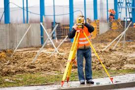
Subdivision Survey: This type of survey divides existing parcels into smaller parcels. These types of surveys are required to be recorded at the county recorder's office and must also meet all requirements of government agencies. State standards require a minimum of two permanent monuments per block.
Topographic Survey: Although these are generally performed by a Land Surveyor, other professionals, such as Engineers and Architects may also complete them. These types of surveys are graphic representations of physical features of the land depicting natural and man-made features, such as fences, buildings, utilities, hills, valleys streams, lakes, roads, etc. They can be performed by field ground methods or by aerial photographic methods. The preciseness of this type of survey depends on what it is to be used for. These surveys should be completed in conjunction with a ''Boundary Survey'' (which can only be performed by a Professional Land Surveyor) to show lines of possession.
Plot Plan or Site Plan:This type of survey may be required by local authorities or you may require it to insure that a proposed house or structure is constructed in the proper location and not over an easement or building set back line. A drawing may be required showing the proposed building location.
Surveyors Real Property Report: This is a report on the location of improvements and a cursory check for encroachments onto or from the subject property based on existing evide
|
|
 DiBernardo Associates Vermont & New Hampshire Land Surveyors
440 Rockingham Road Bellows Falls, Vermont 05101 & 2 Taylor Street No. Walpole, NH 03609
Phone 802-463-3031 or in New Hampshire Call 603-358-5509 Email Us
VT Land Surveyor, NH Land Surveyor, Keene NH Land Surveyor, New Hampshire Land Surveyor, Vermont, Keene NH, Bellows Falls VT, DiBernardo Associates, Di Bernardo Assoc, Connectivut Valley, Land Project, Boundary, Subdivision, Topographic, FEMA, Land Survey Project Engineers
|
|
 |